Advertisements
Advertisements
Question
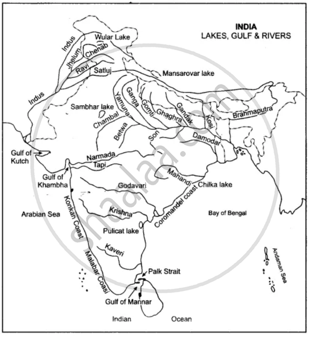
One the map of India:
(a) Label the rivers: Mahanadi, Kaveri, Chambal, Betwa.
(b) Show by an arrow and name the Gulfs: Khambat, Kutch, Mannar
(c) Name the Lakes: Chilka and Pulicat.
(d) Write in bold letters Bay of Bengal, Arabian Sea, Indian Ocean in their appropriate places.
Advertisements
Solution
APPEARS IN
RELATED QUESTIONS
Name the world’s first and second highest mountain peaks.
Which is known as the Deccan Trap region?
Which is the highest peak of the Peninsular India?
Where does the Karnataka Plateau end?
Describe the Deccan Plateau region.
What is the importance of the Southern Plateau Region?
What are the salient characteristics of Shivaliks?
Give reasons to justify that the Himalayas act as a ‘climatic divide’.
The Peninsular Plateau of India was a part of Gondwana Land hundreds of millions years ago.
Why is ‘The Delta region of the Indus is largely a waste land.’
