Advertisements
Advertisements
प्रश्न
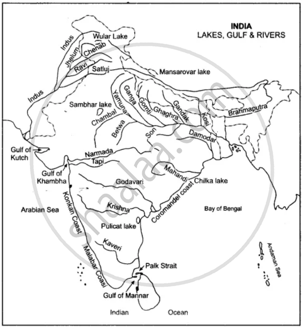
One the map of India:
(a) Label the rivers: Mahanadi, Kaveri, Chambal, Betwa.
(b) Show by an arrow and name the Gulfs: Khambat, Kutch, Mannar
(c) Name the Lakes: Chilka and Pulicat.
(d) Write in bold letters Bay of Bengal, Arabian Sea, Indian Ocean in their appropriate places.
Advertisements
उत्तर
APPEARS IN
संबंधित प्रश्न
Name the mountain ranges that lie along east and west of Pamir Knot.
Mention the sub-units into which the Deccan Plateau region can be divided.
Which is known as the Deccan Trap region?
Which is the highest peak of the Peninsular India?
“Access through Western Ghats is difficult.” Why?
How has the lava-flow rocks of Deccan Plateau changed into fertile black soils?
The Peninsular Plateau of India was a part of Gondwana Land hundreds of millions years ago.
Why is ‘The Delta region of the Indus is largely a waste land.’
The Eastern Coastal Plain and Western Coastal Plain.
Name the ranges in the western branch of the Himalayas.
