Advertisements
Advertisements
प्रश्न
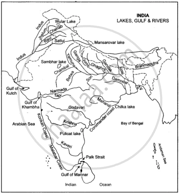
One the map of India:
(a) Label the rivers: Mahanadi, Kaveri, Chambal, Betwa.
(b) Show by an arrow and name the Gulfs: Khambat, Kutch, Mannar
(c) Name the Lakes: Chilka and Pulicat.
(d) Write in bold letters Bay of Bengal, Arabian Sea, Indian Ocean in their appropriate places.
Advertisements
उत्तर
APPEARS IN
संबंधित प्रश्न
Name the mountain ranges that lie along east and west of Pamir Knot.
Where is Zojila Pass?
Mention the sub-units into which the Deccan Plateau region can be divided.
Mention the sub-units of the Deccan Plateau?
Which is known as the Deccan Trap region?
(i) Give a brief note on Islands of India.
(ii) Where does the Lakshadweep group of islands lie?
What, has been the influence of the Northern Mountain Wall on the Indian Sub-continent?
The Peninsular rivers not navigable.
Delta and an estuary.
Name the five most important peaks of the Himalayan Range.
