Advertisements
Advertisements
Question
______ in a map which explains the different colours and symbols used in it.
Advertisements
Solution
Legend in a map which explains the different colours and symbols used in it.
APPEARS IN
RELATED QUESTIONS
Answer the following question in brief.
What are the latitudinal and longitudinal extents of India? Use your atlas to find the answer.
Answer the following question in one or two paragraphs.
Explain the functions of the north line and legend on a map.
Answer the following question in one or two paragraphs.
Explain why colours are used in maps?
Fill in the blank
Roads, rail tracks, wells, etc. are ________ features on a map.
Write True or False. Correct the false statement.
Terrace farming is undertaken on hilly slopes.
Look at the symbols given here and answer the following question.
What does symbols 1 and 2 show?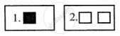
Look at the symbols given here and answer the following question.
How do the features shown by these two symbols differ?
Your friend has invited you to his house. He has drawn a rough sketch on a paper showing the direction to his house for you.
How does the sketch help you? What quality of your friend is shown through in this gesture?
What are cardinal directions?
The features of White colour in Map is ______.
