Please select a subject first
Advertisements
Advertisements
if `x^m y^n = (x + y)^(m + n)`, prove that `(d^2y)/(dx^2)= 0`
Concept: Logarithmic Differentiation
If x = a (2θ – sin 2θ) and y = a (1 – cos 2θ), find `dy/dx` when `theta = pi/3`
Concept: Derivatives of Functions in Parametric Forms
If x = A cos 4t + B sin 4t, then `(d^2x)/(dt^2)` is equal to ______.
Concept: Second Order Derivative
Find the intervals in which the function f(x) = 3x4 − 4x3 − 12x2 + 5 is
(a) strictly increasing
(b) strictly decreasing
Concept: Increasing and Decreasing Functions
If the sum of lengths of hypotenuse and a side of a right angled triangle is given, show that area of triangle is maximum, when the angle between them is π/3.
Concept: Maxima and Minima
Find the intervals in which f(x) = sin 3x – cos 3x, 0 < x < π, is strictly increasing or strictly decreasing.
Concept: Increasing and Decreasing Functions
The side of an equilateral triangle is increasing at the rate of 2 cm/s. At what rate is its area increasing when the side of the triangle is 20 cm ?
Concept: Increasing and Decreasing Functions
Find the local maxima and local minima, of the function f(x) = sin x − cos x, 0 < x < 2π.
Concept: Maximum and Minimum Values of a Function in a Closed Interval
Find the value(s) of x for which y = [x(x − 2)]2 is an increasing function.
Concept: Increasing and Decreasing Functions
Show that the function f(x) = 4x3 - 18x2 + 27x - 7 is always increasing on R.
Concept: Increasing and Decreasing Functions
The total cost C(x) associated with the production of x units of an item is given by C(x) = 0.005x3 – 0.02x2 + 30x + 5000. Find the marginal cost when 3 units are produced, whereby marginal cost we mean the instantaneous rate of change of total cost at any level of output.
Concept: Rate of Change of Quantities
Find the dimensions of the rectangle of perimeter 36 cm which will sweep out a volume as large as possible, when revolved about one of its sides. Also, find the maximum volume.
Concept: Maxima and Minima
A particle moves along the curve 3y = ax3 + 1 such that at a point with x-coordinate 1, y-coordinate is changing twice as fast at x-coordinate. Find the value of a.
Concept: Rate of Change of Quantities
Read the following passage:
Engine displacement is the measure of the cylinder volume swept by all the pistons of a piston engine. The piston moves inside the cylinder bore.
|


Based on the above information, answer the following questions:
- If the radius of cylinder is r cm and height is h cm, then write the volume V of cylinder in terms of radius r. (1)
- Find `(dV)/(dr)`. (1)
- (a) Find the radius of cylinder when its volume is maximum. (2)
OR
(b) For maximum volume, h > r. State true or false and justify. (2)
Concept: Maxima and Minima
Read the following passage:
|
The use of electric vehicles will curb air pollution in the long run. V(t) = `1/5 t^3 - 5/2 t^2 + 25t - 2` where t represents the time and t = 1, 2, 3, ...... corresponds to years 2001, 2002, 2003, ...... respectively. |
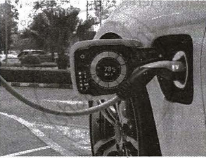
Based on the above information, answer the following questions:
- Can the above function be used to estimate number of vehicles in the year 2000? Justify. (2)
- Prove that the function V(t) is an increasing function. (2)
Concept: Increasing and Decreasing Functions
Write the antiderivative of `(3sqrtx+1/sqrtx).`
Concept: Integration as an Inverse Process of Differentiation
Evaluate : `∫(sin^6x+cos^6x)/(sin^2x.cos^2x)dx`
Concept: Integration as an Inverse Process of Differentiation
Evaluate : `int(x-3)sqrt(x^2+3x-18) dx`
Concept: Methods of Integration> Integration by Substitution
Evaluate `int_0^(pi)e^2x.sin(pi/4+x)dx`
Concept: Methods of Integration> Integration by Parts
Find `intsqrtx/sqrt(a^3-x^3)dx`
Concept: Methods of Integration> Integration by Substitution
