Please select a subject first
Advertisements
Advertisements
The figure given alongside refers to a major International Conference on the environment. This was held in ______.

Concept: International Cooperation
Assertion (A): The satellite imagery is used for collecting data on environmental damage.
Reason (R): This data collection helps in marketing and selling of forest products.
Concept: Technology that Sustains
Explain any two areas of global environmental issues which are addressed by GEF.
Concept: International Cooperation
A satellite city is a ______.
Concept: Technology that Sustains
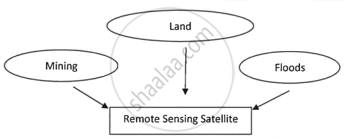
Suggest five reasons why has the above technology become very prominent and beneficial.
Concept: Technology that Sustains
How does GEF help in bringing about sustainability?
Concept: International Cooperation
Name the following: An offshore oil field in the Gulf of Cambay.
Concept: Topographic or Ordnance Survey Maps
Name the following:
An oil refinery in Bihar.
Concept: Topographic or Ordnance Survey Maps
Name the state that produces the largest amount of limestone.
Concept: Topographic or Ordnance Survey Maps
Give the four figure grid reference of the settlement of Hamirpura.
Concept: Topographic or Ordnance Survey Maps
Give the four figure grid reference of the temple in the settlement of Jolpur.
Concept: Topographic or Ordnance Survey Maps
What does the blue coloured circle in the grid square 0619 represent?
Concept: Topographic or Ordnance Survey Maps
What is the compass direction of Dantrai from Jolpur?
Concept: Topographic or Ordnance Survey Maps
What is the difference between the pattern of settlements in 0725 and the settlement of Idarla?
Concept: Topographic or Ordnance Survey Maps
What is the difference between the drainage pattern of the streams in 0624 and those in 0824?
Concept: Topographic or Ordnance Survey Maps
How does the feature, indicated by the black curves in 0721, show that rainfall in this region is seasonal?
Concept: Topographic or Ordnance Survey Maps
Mention one man-made feature in the map, which also provides evidence that the rainfall is seasonal.
Concept: Topographic or Ordnance Survey Maps
Name two natural features in 0527.
Concept: Topographic or Ordnance Survey Maps
Name two natural features in 0325.
Concept: Topographic or Ordnance Survey Maps
What are the following?
The black vertical line between eastings 09 and 10
Concept: Topographic or Ordnance Survey Maps
