Advertisements
Advertisements
प्रश्न
Collect photographs of typical rural houses and clothing of people from different regions of India. Examine whether they reflect any relationship with the climatic condition and relief of the area.
Advertisements
उत्तर
Housing:
Desert areas-
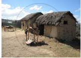
The climate in the deserts is extreme. The summers are very hot and dry. Sandstorms are common in this season. Water becomes scarce and in many places, there is a severe drought. Most places receive little or no rainfall.
North-eastern areas-

Northeast is not a single unit. It consists of 7 states with people belonging to diverse cultures, ethnic groups, and religions. A person living in Assam will have a very different lifestyle from an individual living in Manipur. Life in the cities and small towns is different from life in far-flung villages. However, there’s one characteristic in most Northeastern states that is common and that is simplicity.
South India:
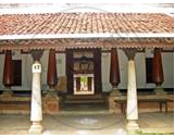
Different states of South India have different cultures. Different states have their own festivals, dance forms, and food preferences. The climate, however, is similar in these states due to their close geographical proximity.
Clothing:
- You might find in Rajasthan, people wearing loose cotton clothes as day experiences real hot weather and night experiences real chilly weather, and people at nightwear warm clothes.
- In Jammu and Kashmir, people experience cold all time and so their dresses are designed likewise to avoid chillness.
- Chennai and places like Bangalore experience moderate climate so they wear cotton or synthetic clothes. (type of clothing style changes from season to season in these areas)
संबंधित प्रश्न
Give reason as to why.
Parts of Rajasthan, Gujarat and the leeward side of the Western Ghats are drought-prone.
Explain the importance of the Himalayas and the Indian Ocean with respect to the climate of India.
We wear cotton during ______.
Match the following.
| 1. | Kerala | Kachch |
| 2. | Arunachal Pradesh | Gulf of Mannar |
| 3. | Great Nicobar | Dihang Dihang |
| 4. | Gujrat | Andaman & Nicobar Isands |
| 5. | Tamil Nadu | Agasthyamalai |
The Himalayas act not only as physical barrier but also as ______.
Which important endangered animal is found in the jungles of Assam and West Bengal?
Mark the following on the outline map of India.
- Direction of South West Monsoon wind.
- Direction of North East Monsoon wind.
- Areas of heavy rainfall.
- Mountain forests.
- Panna biosphere reserve
- Agasthiyamalai biosphere reserve
Observe the following graph and answer the questions given below:
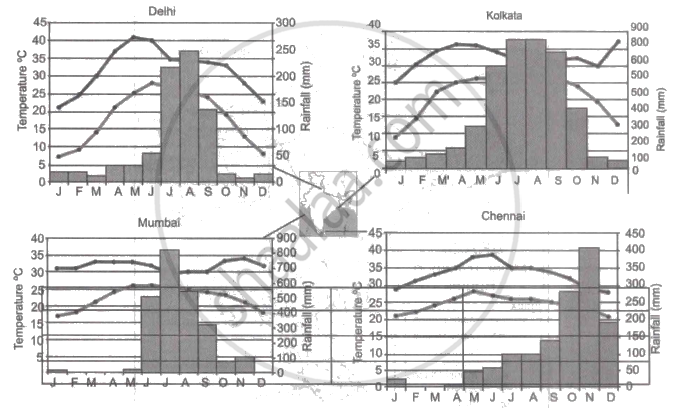
Note: In the graphs, the dark line represents the max. temperature and the lighter line represents min. temperature. The bars represent the amount of rainfall every month in each city.
- Where in the four cities is the rainfall heaviest?
- Which city has the most rainfall throughout the year?
- Which city experiences the highest temperature?
- Calculate the average range of minimum and maximum temperature for all four cities.
- What do the temperature curves in Delhi indicate?
- What is the condition of Mumbai during monsoons?
Why houses in Assam are built on stilts?
Study the climatic data of station X and answer the following questions:
| Month | Jan | Feb | Mar | Apr | May | Jun | July | Aug | Sep | Oct | Nov | Dec |
| Temp (°C) | 23.1 | 24.8 | 26.5 | 29.3 | 32 | 32.8 | 33.1 | 32.1 | 30.5 | 29.3 | 28.7 | 26.1 |
| Rainfall (cm) | 7.3 | 1.1 | 0.3 | 0.1 | 1.3 | 4.5 | 6.1 | 8.2 | 8.5 | 20.1 | 20.8 | 9.0 |
- What is the annual range of temperature of station X?
- Which is the driest month?
- Name the wind that brings maximum rainfall to this station.
