Advertisements
Advertisements
प्रश्न
Answer the following question in one or two paragraphs.
What is the grid system ? Why is it important?
Advertisements
उत्तर
A network of horizontal and vertical lines or latitudes and longitudes are drawn on a map or globe is called the grid system.
The grid system is an important feature of maps. It helps in locating places on the surface of the earth. For example, if you wanted to locate a place, you would look for its latitude and longitude. The location of the place would be at the intersection of its latitude and longitude.
APPEARS IN
संबंधित प्रश्न
Answer the following question in brief.
What are the latitudinal and longitudinal extents of India? Use your atlas to find the answer.
Answer the following question in one or two paragraphs.
Explain the functions of the north line and legend on a map.
Answer the following question in one or two paragraphs.
Explain why colours are used in maps?
Make a clay globe in your art class and mark the major latitudes and longitudes using the following colours. Blue, green, and brown.
Look at the symbols given here and answer the following question.
What does symbols 1 and 2 show?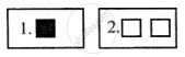
______ in a map which explains the different colours and symbols used in it.
Choose the odd one
What are the colours used in the maps?
The features of ______ colour in Map is Mountain, Hill, and Contour.
On the map, the police station is denoted by the symbol ______.
