Topics
Representation of Geographical Features
Maps and Diagrams
- Maps - Our Companions
- Importance of Maps
- Types of Maps Based on Scale
- Scale Meaning and Uses
- Direction: Eight Cardinal Points
- Symbols
- Diagrams (With Brief Explanation)
Elements of a Map
- The Role of Standard Signs and Symbols in Map Interpretation
- Types of Maps Based on Scale
- Scale Meaning and Uses
- Symbols
- Direction: Eight Cardinal Points
Landforms
- Types of Landforms
- Mountains and Valleys
- Mountain Types - Folding
- Mountain Types - Faulting
- Importance of Mountains
- Mountain Types - Volcanic
- Valleys: Formations and Characteristics
- Plains
- Landforms and People
Major Landforms of the Earth
Water Bodies: Oceans, Seas, Lakes and Rivers
Major Water Bodies
- Oceans
- Sea
- Lakes
- Rivers
- Locating Oceans, Seas, Lakes and Rivers on the World Map
Agriculture
Types of Agriculture
- Introduction to Different Types of Agriculture
- Types of Farming in India > Subsistence Farming
- Major Crops: Food Crops
- Types of Farming in India > Commercial Farming
Major Crops
- Major Crops: Food Crops
- Types of Farming in India > Commercial Farming
- Locate Major Crop Producing Region on the World Map
Minerals
Minerals and Ores Exercises
- Minerals
- Classification of Minerals
- Distribution of Minerals in India
- Types of Mining
- Conservation of Minerals
- Location of Above Minerals on the World Map
Study of Continents : North America and South America
North America: Location, Area, Political and Physical Features
- A Brief Idea of the Formation of Continents
- North America : Location
- North America : Boundaries
- North America : Political Divisions (Countries and Capitals)
- North America : Major Physical Features
North America: Climate, Natural Vegetation, Wildlife; Mineral and Power Resources
- A Brief Idea of the Formation of Continents
- North America : Climate
- North America: Natural Vegetation
- North America: Wildlife
- North America: Mineral and Power Resources
South America: Location, Area, Political and Physical Features
- A Brief Idea of the Formation of Continents
- South America: Location
- South America: Boundaries
- South America: Political Divisions
- South America: Major Physical Features
South America: Climate, Natural Vegetation, Wildlife; Mineral and Power Resources
- A Brief Idea of the Formation of Continents
- South America: Climate
- South America: Natural Vegetation
- South America: Wildlife
- South America: Mineral and Power Resources
Maharashtra State Board: Class 5
The Role of Standard Signs and Symbols in Map Interpretation:
Many people use maps. Many components are shown in maps or outline maps. If these components are shown on different maps in different ways, it will be difficult to understand them. Therefore, standard signs and symbols are used to make the map easy to read. These symbols and signs are universally used for specific components. That is why everyone can understand them.
1. Conventional signs
- Signs are used to show various things on a map as per convention.
- These are in the form of letters or geometrical shapes, for example, lines, circles, triangles, dots, etc.
2. Conventional symbols
- Symbols are used to show various things on a map as per convention. Symbols are miniature drawings of the respective objects.
- For example, temples, mosques, forts, etc. The use of signs and symbols on a map helps the reader to get exact information about the places on the map.
- A list of the things that the signs and symbols represent is given in the key to the map.
| Symbol | Description |
|---|---|
|
PO
|
Post Office |
 |
Harbour |
 |
Lighthouse |
 |
Fort |
 |
Burial Ground |
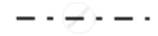 |
International Boundary Line |
 |
Battlefield |
 |
Railway |
 |
Well |
 |
Spring |
 |
Triangulation Mark |
 |
Settlement |
 |
Grass |
 |
Contour Line |
 |
Lake |
 |
Road |
 |
Mine |
 |
Reserved Forest |
