Advertisements
Advertisements
प्रश्न
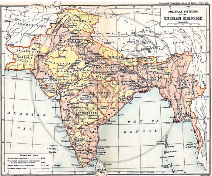
Examine the map. What are the main differences with the map of today’s India, in terms both of borders and of names?
अंतर स्पष्ट करें
Advertisements
उत्तर
1. Borders:
- During the British reign in 1909, India included Pakistan, Bangladesh, and Myanmar (Burma) as well.
- These countries have become separate nations now.
- The northwestern border included Baluchistan and the North West Frontier Province (now in Pakistan).
2. Some places are called with different names now. For example:
- Calcutta is now Kolkata
- Bombay is now Mumbai
- Madras is now Chennai
- Burma is now Myanmar
- During British rule the regions were called Provinces, Agencies, or Native States, which no longer exist under those names.
3. Territories:
- The map shows areas in pink as “British India” (directly ruled by the British).
- Areas in yellow were “Native States” ruled by Indian kings under British control.
- Today, all areas are part of the Republic of India, with states and union territories except neighbouring countries Pakistan, Bangladesh and Myanmar, which were formed later.
4. Railways: The map also shows railway lines which were important during British rule for transport and control.
shaalaa.com
क्या इस प्रश्न या उत्तर में कोई त्रुटि है?
