Advertisements
Advertisements
प्रश्न
On the outline map of Europe, use different colours to mark and label the following:
- Oceans—Arctic, Atlantic
- Seas—Mediterranean, Baltic, North Sea
- Straits—Dover, Gibraltar
- Plateau—Central Massif, Meseta
- Mountains—Alps, Pyrenees, Carpathians
- Rivers—Danube, Rhine, Volga
- Lakes—Ladoga, Onega, Vanern
- Capitals—Paris, Moscow, Berl
Advertisements
उत्तर

APPEARS IN
संबंधित प्रश्न
What are fiords? How are they formed?
Refer to the physical map of Europe in your atlas. Moving in an anti-clockwise direction starting from the Arctic Ocean and the White Sea, observe and note down the names of all the surrounding water bodies such as seas, bays, gulfs, straits, etc. Then mark each of them on an outline map of Europe.
Give geographical reasons:
People faced many difficulties while exploring Africa.
Name the major mountain ranges of Africa.
Name the lakes found in the Great Rift Valley.
Write True or False. Correct the false statement.
The Kalahari Desert is located in North Africa.
Identify the hot deserts of Africa and briefly describe the climatic conditions in terms of temperature and rainfall.
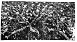
This is a photograph of Australia’s Great Barrier Reef. Why do you think this reef is Australia’s biggest tourist attraction.
What is the name of the temperate grassland in Australia?
The platypus is considered a strange animal. Why?
