Advertisements
Advertisements
प्रश्न
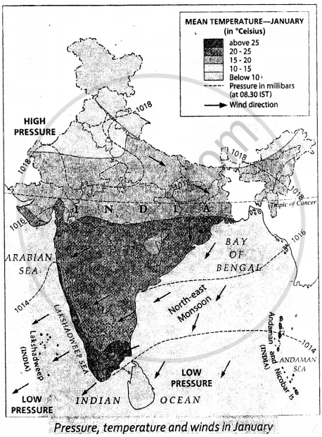
On an outline map of India, show the path of the northeast monsoons with arrows.
Advertisements
उत्तर
APPEARS IN
संबंधित प्रश्न
Fill in the blank:
The state that first receives the monsoon rains: ___________
Which winds bring rainfall to the Western Ghats?
Why do Punjab and Rajasthan get very little rainfall during the monsoons?
On an outline map of India, do as directed :
Mark with red arrows the paths of the Arabian Sea branch and the Bay of Bengal branch of the south-west monsoon.
On an outline map of India, do as directed :
Shade in yellow the rain shadow regions of the Western Ghats.
Name :
The wettest place in India.
Write short notes on :
Thorn and Desert forest
Fill in the blank:
The southern part of India is _______ all year round.
Fill in the blank:
The winter rainfall is very important for the cultivation of _________ crops such as wheat.
On an outline map of India, show the annual distribution of rainfall.
