Advertisements
Advertisements
प्रश्न
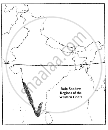
On an outline map of India, do as directed :
Shade in yellow the rain shadow regions of the Western Ghats.
Advertisements
उत्तर
APPEARS IN
संबंधित प्रश्न
Write true or false. Correct the false statement:
Thorn forests occupy the largest area in India
Answer the following question in brief
State two ways in which the Himalayas act as a climate barrier.
Explain the importance of monsoon.
List the different types of vegetation found in India. Describe any two.
Which latitude divides India into two nearly equal parts?
What is a loo?
Name the showers that help in the ripening of mangoes in Kerala?
Temperature ______ with increase in height above sea level.
On an outline map of India, show the path of the northeast monsoons with arrows.
On an outline map of India, show the annual distribution of rainfall.
