Advertisements
Advertisements
प्रश्न
Look at the transport maps of India given in the figures and answer the following questions.

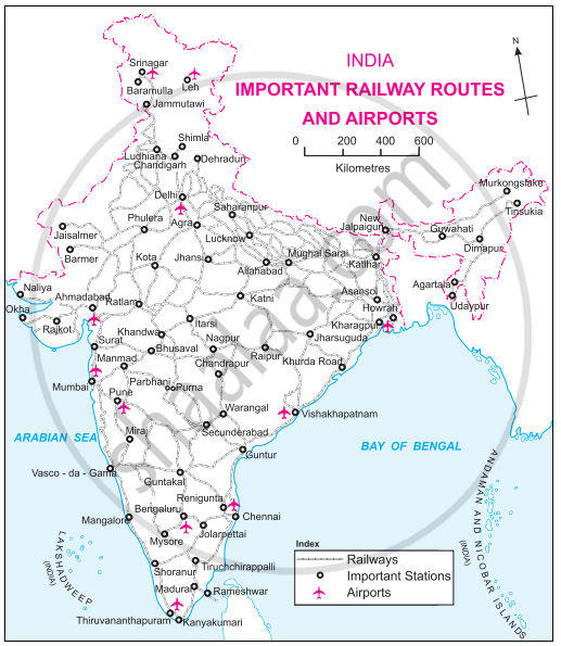
- Which means of transport are visible on the map?
- In which part of India is the density of railways more?
- Name five important ports and airports of India.
- Which parts of India have a sparse network of transport? What could be the reason?
Advertisements
उत्तर
- The means of transport visible on the map are waterways, railways and airways.
- The density of railways is higher in the Northern Plains region.
- Ports: Mumbai, Vishakhapatanam, Haldia, Chennai and Kandla.
Airports: Delhi, Mumbai, Bengaluru, Chennai, and Kolkata. - The north and the north-east parts of India have a sparse network of transport. Due to mountainous and snow-covered areas in the north and the dense inaccessible forest areas of the north-east, the transportation network is sparse here. Also, these regions have low population and a lack of economic opportunities.
APPEARS IN
संबंधित प्रश्न
Give geographical reasons for the following:
A dense network of railways has developed in the North Indian plains.
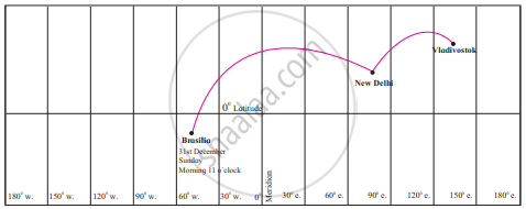
A plane leaves Brasilia at 11 am on 31st December. The plane crosses 0° Meridian and reaches Vladivostok via New Delhi. Tell the local time, date and day at New Delhi and Vladivostok when plane leaves Brasilia.
Write a note on air transport in India.
Differentiate between.
Water transport in the Amazon and the Ganga river.
In India, sparse network of railway is found in ______.
State whether right or wrong-
Railway network is less dense in the North Indian plains.
Write answer in one sentence-
Which is the costliest mode of transportation?
Compare the transportation facilities of Brazil and India and state your conclusions.
The transportation in India with the importance of railways.
Observe the map of India and answer the following question.
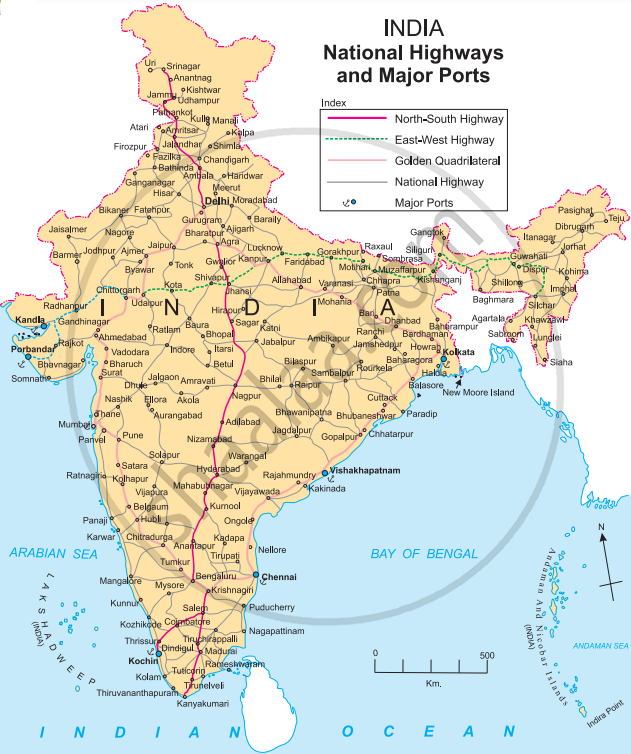
- What is the title and subtitle of the map?
- Which part has more density of roadways?
- Name two ports to the western coast.
- Name the highway that connects Porbandar and Silchar.
- Name the island near Kolkata.
