Advertisements
Advertisements
प्रश्न
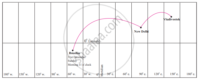
A plane leaves Brasilia at 11 am on 31st December. The plane crosses 0° Meridian and reaches Vladivostok via New Delhi. Tell the local time, date and day at New Delhi and Vladivostok when plane leaves Brasilia.
Advertisements
उत्तर
The local time, date and day at New Delhi and Vladivostok when plane leaves Brasilia will be as follows:
| City | Local time | Day | Date |
| Brasilia | 11 am | Monday | 31st December |
| Delhi | 7.30 pm | Monday | 31st December |
| Vladivostok | 12 am | Tuesday | 1st January |
APPEARS IN
संबंधित प्रश्न
Give geographical reasons for the following:
A dense network of railways has developed in the North Indian plains.
Give geographical reasons.
Development of transport is important for a country’s progress.
Write a note on air transport in India.
Arun called his mother from Digboi at 7 am. At what local time will his mother pick up his call at Jaisalmer?
State whether right or wrong-
Railway network is less dense in the North Indian plains.
Write answer in one sentence-
Which is the costliest mode of transportation?
Compare the transportation facilities of Brazil and India and state your conclusions.
The transportation in India with the importance of railways.
Look at the transport maps of India given in the figures and answer the following questions.
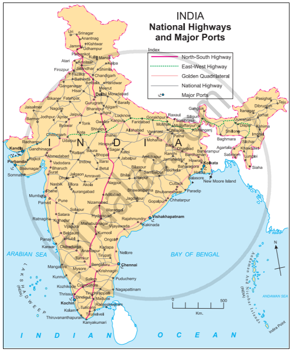
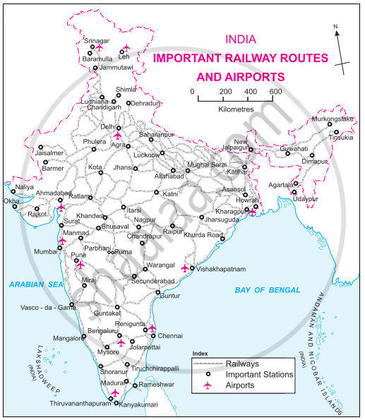
- Which means of transport are visible on the map?
- In which part of India is the density of railways more?
- Name five important ports and airports of India.
- Which parts of India have a sparse network of transport? What could be the reason?
Observe the map of India and answer the following question.
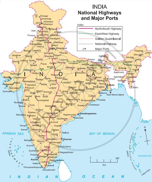
- What is the title and subtitle of the map?
- Which part has more density of roadways?
- Name two ports to the western coast.
- Name the highway that connects Porbandar and Silchar.
- Name the island near Kolkata.
