Advertisements
Advertisements
प्रश्न
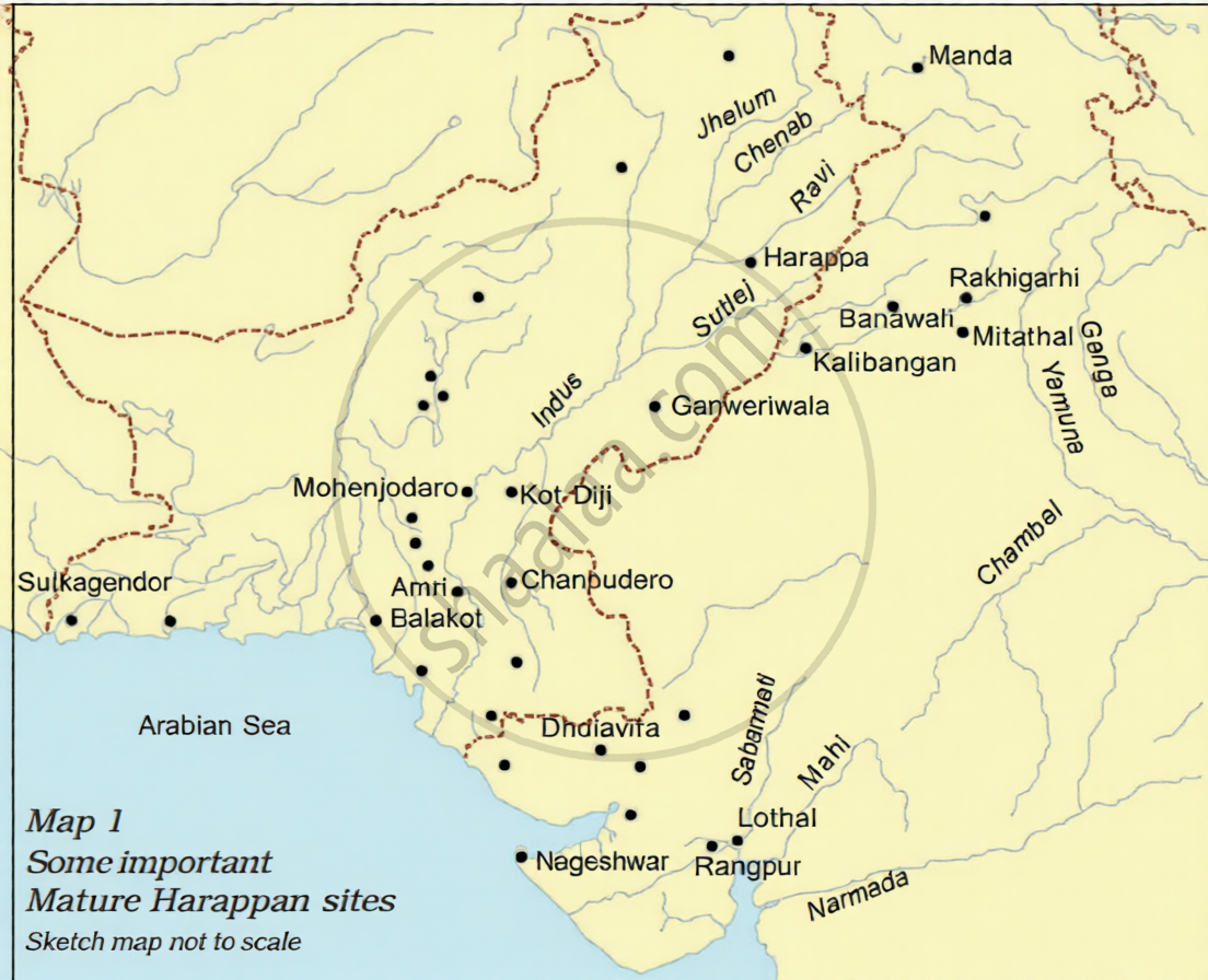
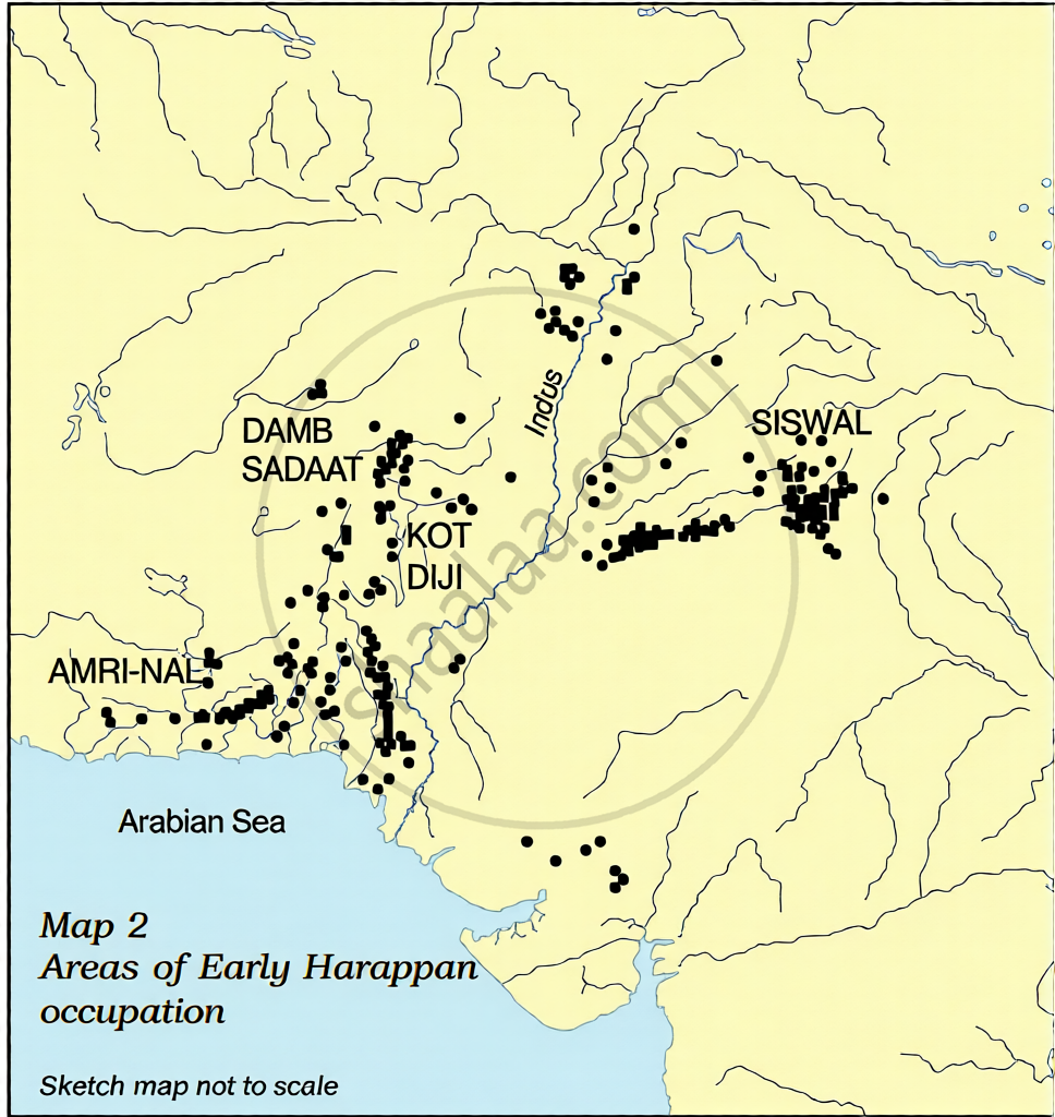
Are there any similarities or differences in the distribution of settlements shown on the maps?
कृति
Advertisements
उत्तर
The similarities in the distribution of settlements on the maps are:
- River Valley Centricity: Both maps show that the primary concentration of settlements is heavily clustered around the Indus River and its major tributaries (Jhelum, Chenab, Ravi, Sutlej).
- Core Continuity: Key nuclear areas like Kot Diji and Amri show continuous occupation, serving as prominent settlements in both the Early and Mature phases.
- Coastal Presence: Both maps display a strategic presence along the Arabian Sea coast (the Makran and Gujarat coastal regions), showing that maritime access was important from the beginning.
The differences in the distribution of settlements on the maps are:
| Feature | Map 1: Mature Harappan Sites | Map 2: Early Harappan Occupation |
| Geographical Spread |
Expands vastly into Gujarat (Lothal, Dholavira) and East toward the Ganga-Yamuna Doab. | Restricted to localised regional pockets (Balochistan, Sindh, and Punjab). |
| Settlement Nature |
Widely spaced, planned urban cities and specialised trading outposts. | Densely packed, small agricultural or pastoral clusters. |
| Cultural Zones |
Integrated into a uniform, highly standardised pan-Indus urban civilisation. | Divided into distinct regional cultures like Amri-Nal, Damb Sadaat, and Siswal. |
| Specialized Sites |
High specialisation, such as Nageshwar/Balakot for shell-working and Lothal for maritime trade. | General occupational sites with low functional differentiation. |
The shift from Map 2 to Map 1 represents a structural transition from rural, localised chalcolithic cultures to a highly integrated, urbanised state society. The Mature Harappan phase successfully expanded into new resource-rich ecological zones (like Gujarat for shells and semi-precious stones) to fuel its vast administrative and trading networks
shaalaa.com
क्या इस प्रश्न या उत्तर में कोई त्रुटि है?
