Advertisements
Advertisements
प्रश्न
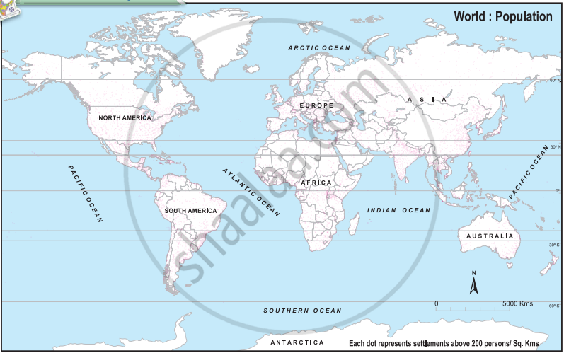
Refer to the map showing rice producing regions of the world in Fig. 1. Relate it with the population map of the world in Fig. 2. Write the conclusions in your own words.
Fig 1:
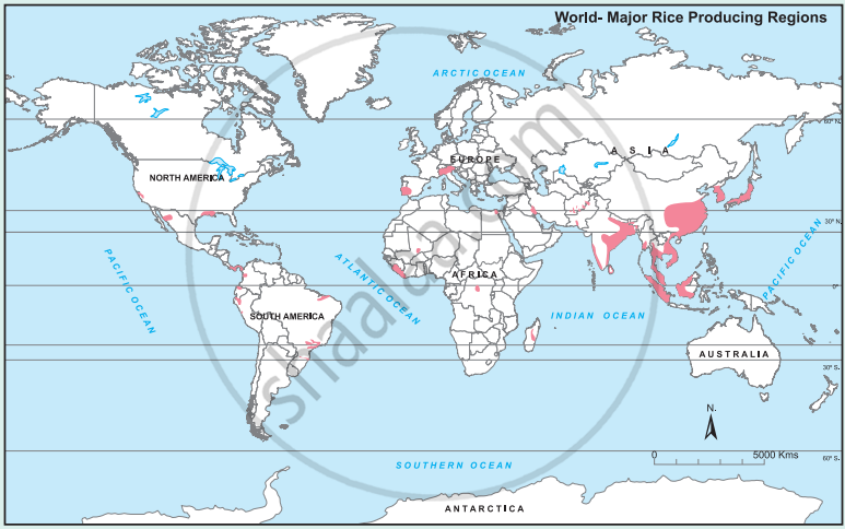
Fig 2:
सविस्तर उत्तर
Advertisements
उत्तर
After comparing the rice-producing regions map with the world population map, the following conclusions can be drawn:
- Most major rice-producing regions are also densely populated. This is clearly seen in South, Southeast and East Asia.
- Countries such as India, China, Bangladesh, Japan, Vietnam, Thailand and Indonesia have large rice-producing areas and also high population concentration.
- Rice cultivation requires warm climate, sufficient rainfall or irrigation, fertile soil and plenty of labour. These conditions also support dense human settlement.
- River valleys, deltas and coastal plains are suitable for rice cultivation and therefore often have high population density.
- Areas with very cold, dry or mountainous conditions have little rice cultivation and generally lower population density.
Thus, there is a close relationship between rice-producing regions and densely populated areas, especially in Asia.
shaalaa.com
या प्रश्नात किंवा उत्तरात काही त्रुटी आहे का?
