Advertisements
Advertisements
प्रश्न
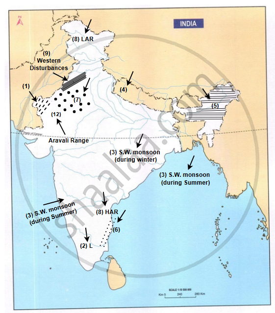
On the outline map of India:
- Colour the areas which receive less than 30 cm rainfall in a year.
- Write L over the region which is the last to receive the South-West Monsoon.
- Show by arrows, the direction of the rain bearing winds during winter and summer.
- Mark the wind direction in Ganga basin and Tamil Nadu coast in the month of January.
- Shade an area which receives rain in January and February.
- Shade and name the regions of India which experience cyclonic rain and convectional rain.
- Mark dots on the areas which are affected by Loo.
- Write HAR in an area having high annual range of temperature and LAR in an area having low annual range of temperature.
- Shade in different colours or patterns the three sources of rain in Punjab.
- Mark and name the mountain range and the direction of rain-bearing winds as a result both of which Rajasthan gets scanty rainfall.
नकाशा
Advertisements
उत्तर
shaalaa.com
या प्रश्नात किंवा उत्तरात काही त्रुटी आहे का?
पाठ 6: Climate - EXERCISES [पृष्ठ ९५]
