Please select a subject first
Advertisements
Advertisements
Comment upon the type of weathering which will occur in the Tropical Monsoon Climate region.
Concept: undefined >> undefined
Read the graphs figure a and b and answer the following questions. Locate the places on the map:


- Name the months of highest and lowest rainfall. What is the difference between the values of rainfall?
- Name the months of the highest and the lowest temperatures.
- Are the months of rainfall the same in both places? If not, why?
- What could be the factors which influence the climate of these places?
- What difference do you find between the graphs in figure b) and figure a)?
- Write a concluding statement about the climate of both places?
Concept: undefined >> undefined
Advertisements
Choose the correct alternative:
Monsoon region
Concept: undefined >> undefined
Choose the correct alternative:
The main reason behind the months of precipitation in the graphs of Monsoon climatic regions being different is:
Concept: undefined >> undefined
Give a geographical reason:
In the Monsoon climate region, rainfall occurs in a specific season.
Concept: undefined >> undefined
Identify the incorrect factor:
The indicators of climate change
Concept: undefined >> undefined
Identify the incorrect factor:
The tools for studying climate change
Concept: undefined >> undefined
Give a geographical reason:
It is important to study climate change.
Concept: undefined >> undefined
Write a short note:
Bleaching of coral reefs
Concept: undefined >> undefined
Write a short note:
Flash floods
Concept: undefined >> undefined
Write a short note:
Tools to study Paleoclimatology
Concept: undefined >> undefined
Do you know that India has got the right to mine manganese nodules from the bed of the Indian Ocean from that area which lies beyond the exclusive economic zone? Identify some other resources which are international in nature
Concept: undefined >> undefined
Study maps given in the figure carefully. These maps are showing the portion of the Indian Ocean lying north of the equator. Maps in the figure depict the temperature conditions in three seasons:
- pre-SW monsoon,
- NE monsoon
- during SW monsoon.


Answer the following questions.
- Why are isotherms not drawn on the continental part?
- Why is the temperature in the Arabian Sea lower than in the Bay of Bengal?
- Why is the temperature higher in the southern portion of the Indian Ocean during pre SW monsoon?
Concept: undefined >> undefined
- Name the Gulf countries
- In which direction do they lie in the Asian content.
Concept: undefined >> undefined
Write a short note on:
The width of the continental shelf in the Bay of Bengal and the Arabian Sea.
Concept: undefined >> undefined
Make a list of products found in your home which have come from the Tropical Decidouos Biome.
Concept: undefined >> undefined
1) Various biome regions have been shown on the map. Considering the latitudinal location, select Tropical decidouos biome and write the name in its respective place in the index.
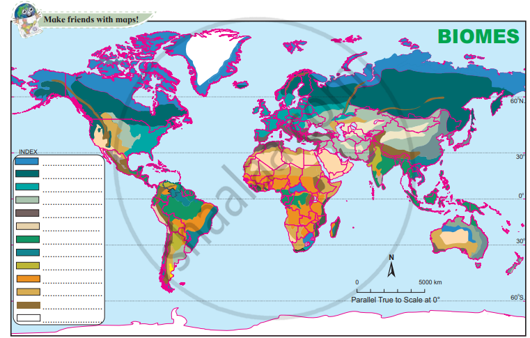
2) Write the names of major countries that lie in the Tropical decidouos biome.
Concept: undefined >> undefined
Look for the names of the tribes dependent on the Tropical decidouos biome in India including Maharashtra along with their habitats and show them on a map of India.
Concept: undefined >> undefined
Write a short note on Carbonation
Concept: undefined >> undefined
